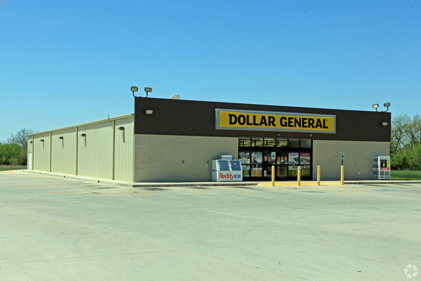
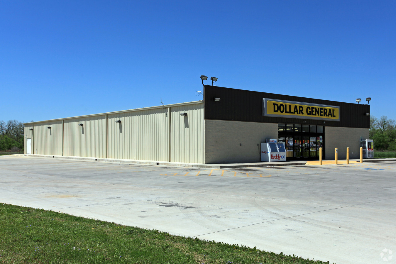
Property Record
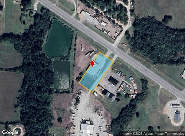
10300 Us Highway 77, Lexington, OK 73051
NEARBY LISTINGS FOR SALE OR LEASE
-
-
View all Lexington listings for sale on LoopNet.com
Property Detail
10300 Us Highway 77
R0168452
7-7-1W 1.80 AC PRT SE/4 BEG N 88D W1843.76` N 01D E1190.52` SE/C SE/4 S 34D W450` N 55D W162.87` N21.44` N 34D E432.32` S 55D E175` POB LESS BEG 912.38`S & S 55D E830.37` NW/C SE/4 S 55D E175` S 34D W48.31` N 55D W175` N 34D E48.61` POB
Storebuilding
Cleveland
X
Oklahoma
40027C0380H
1.60 AC
2023
Southeast Outlying
2023
Oklahoma City
202404
Oklahoma City, OK
9,170 SF
DEMOGRAPHICS near 10300 Us Highway 77
1 Mile
3 Mile
5 Mile
2024 Total Population
730
3,505
15,528
2029 Population
767
3,683
16,874
Pop Growth 2024-2029
+ 5.07%
+ 5.08%
+ 8.67%
Average Age
41
40
40
2024 Total Households
279
1,293
5,788
HH Growth 2024-2029
+ 5.02%
+ 5.26%
+ 8.86%
Median Household Inc
$47,500
$53,606
$69,869
Avg Household Size
2.60
2.70
2.60
2024 Avg HH Vehicles
2.00
2.00
2.00
Median Home Value
$128,658
$147,172
$170,852
Median Year Built
1985
1987
1986
Nearby Places
- Restaurants
- Banks
- Shops
- Fitness
- Groceries
PUBLIC TRANSPORTATION
COMMUTER RAIL
Purcell Amtrak Station (Heartland Flyer - Amtrak)
DRIVE
WALK
Distance
Purcell Amtrak Station (Heartland Flyer - Amtrak)
10 min
6.7 mi
AIRPORT
Will Rogers World
DRIVE
WALK
Distance
Will Rogers World
53 min
34.1 mi
Freight Ports
Tulsa Port Of Catoosa
DRIVE
WALK
Distance
Tulsa Port Of Catoosa
174 min
153.3 mi
Nearby Properties
Address
Land Use
TOTAL SIZE
Lot Size
Zoning
Address
Land Use
TOTAL SIZE
Lot Size
Zoning
9,900 SF
0.79 AC
A1
Address
Land Use
TOTAL SIZE
Lot Size
Zoning
6,000 SF
5 AC
AA
Address
Land Use
TOTAL SIZE
Lot Size
Zoning
5,064 SF
2.87 AC
Address
Land Use
TOTAL SIZE
Lot Size
Zoning
5 AC
A1
Address
Land Use
TOTAL SIZE
Lot Size
Zoning
6,500 SF
3.12 AC
Address
Land Use
TOTAL SIZE
Lot Size
Zoning
9,281 SF
9.02 AC
Address
Land Use
TOTAL SIZE
Lot Size
Zoning
14,190 SF
2.50 AC
Address
Land Use
TOTAL SIZE
Lot Size
Zoning
3.98 AC
Address
Land Use
TOTAL SIZE
Lot Size
Zoning
3,298 SF
3.02 AC
ZN AA
Address
Land Use
TOTAL SIZE
Lot Size
Zoning
3.59 AC
Address
Land Use
TOTAL SIZE
Lot Size
Zoning
21,150 SF
2.26 AC
Address
Land Use
TOTAL SIZE
Lot Size
Zoning
23,363 SF
4.63 AC
Address
Land Use
TOTAL SIZE
Lot Size
Zoning
46,855 SF
2.55 AC
Address
Land Use
TOTAL SIZE
Lot Size
Zoning
12,160 SF
193.12 AC
Address
Land Use
TOTAL SIZE
Lot Size
Zoning
1,837 SF
2.36 AC
A1
Address
Land Use
TOTAL SIZE
Lot Size
Zoning
Address
Land Use
TOTAL SIZE
Lot Size
Zoning
7.01 AC
Address
Land Use
TOTAL SIZE
Lot Size
Zoning
10,000 SF
2.97 AC
A1
Address
Land Use
TOTAL SIZE
Lot Size
Zoning
1,216 SF
2.27 AC
Address
Land Use
TOTAL SIZE
Lot Size
Zoning
13.57 AC
Address
Land Use
TOTAL SIZE
Lot Size
Zoning
45.07 AC
Address
Land Use
TOTAL SIZE
Lot Size
Zoning
19,540 SF
6.65 AC
Address
Land Use
TOTAL SIZE
Lot Size
Zoning
10.89 AC
Address
Land Use
TOTAL SIZE
Lot Size
Zoning
1.68 AC
Address
Land Use
TOTAL SIZE
Lot Size
Zoning
3.38 AC
Address
Land Use
TOTAL SIZE
Lot Size
Zoning
1.68 AC
Address
Land Use
TOTAL SIZE
Lot Size
Zoning
8,800 SF
1.05 AC
Address
Land Use
TOTAL SIZE
Lot Size
Zoning
1.95 AC
The World's #1 Commercial Real Estate Marketplace
Connect with us
© 2025 CoStar Group
The information above has been obtained from sources believed reliable. While we do not doubt its accuracy we have not verified it and make no guarantee, warranty or representation about it. It is your responsibility to independently confirm its accuracy and completeness. Any projections, opinions, assumptions, or estimates used are for example only and do not represent the current or future performance of the property. The value of this transaction to you depends on tax and other factors which should be evaluated by your tax, financial, and legal advisors. You and your advisors should conduct a careful, independent investigation of the property to determine to your satisfaction the suitability of the property for your needs.